Jharkhand Braces for Heavy Rainfall as Low-Pressure Systems Converge

Jharkhand Braces for Heavy Rainfall as Low-Pressure Systems Converge
IMD Warns of Widespread Precipitation and Potential Flooding in Northeastern and Central Regions
Jharkhand’s weather patterns are shifting dramatically as multiple low-pressure systems converge, prompting heightened vigilance across the state.
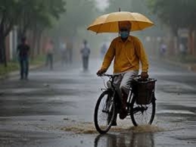
RANCHI – The India Meteorological Department has issued alerts for widespread rainfall and potential flooding in Jharkhand due to converging low-pressure systems.
A well-marked low-pressure area has migrated westward from northwest Jharkhand to southeast Uttar Pradesh and northeast Madhya Pradesh, accompanied by a cyclonic circulation reaching 7.6 km above mean sea level.
Meteorologists predict this system may intensify into a depression over western Madhya Pradesh in the coming days.
Simultaneously, another cyclonic circulation has been detected over the north Bay of Bengal, expected to form a new low-pressure area within 24 hours.
The monsoon trough extends from Jaisalmer to the northeast Bay of Bengal, passing through Kota, Khajuraho, Ranchi, and Contai.
An east-west trough also connects the low-pressure area to the northeast Bay of Bengal at 1.5 km above mean sea level.
"We’re closely monitoring these complex weather patterns and urge residents to stay informed about potential heavy rainfall," stated a meteorological official.
Recent data from the Meteorological Centre reveals a significant improvement in Jharkhand’s rainfall deficit, now reduced to 11 percent.
The state has received 669.5 mm of rain against the normal 751.4 mm for this period, indicating a positive trend in monsoon activity.
Authorities advise residents, particularly in northeastern and central Jharkhand, to prepare for possible localized flooding and disruptions due to the anticipated heavy rainfall.

Join Our Newsletter
Related News
Opinion
You May Also Like
Read More
Discussion
Readers' Comments
Recent
EDITOR PICKS
POPULAR POSTS
MUST READ
ABOUT US
Town Post is a leading News Portal of Jamshedpur and Jharkhand.
FOLLOW US
Contact us: editor@townpost.net
© Town Post, Jamshedpur